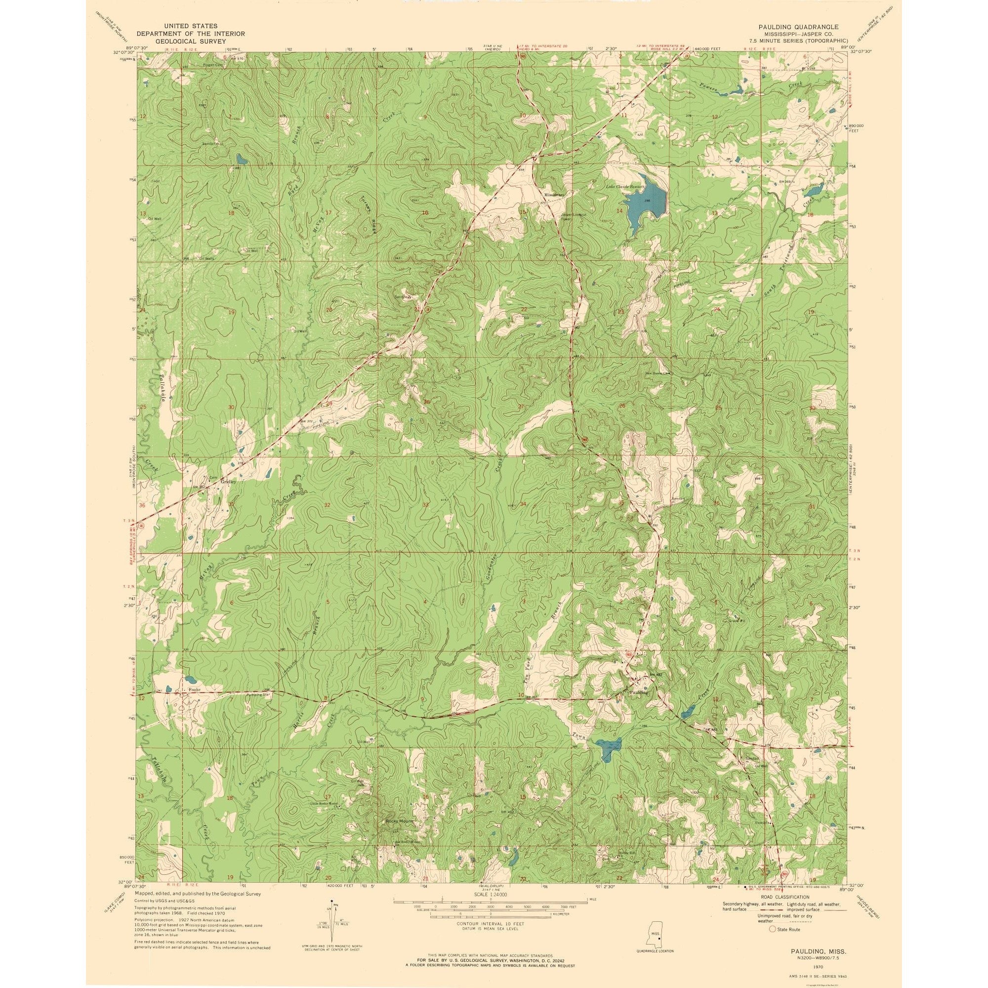
MAPS OF THE PAST USGS 1970 Wall Art 23.00 x 27.85 Unisex
No rating yet(0 ratings)This MAPS OF THE PAST Wall Art reproduces a 1970 USGS topographical map of the Paulding, Mississippi quad. Topographical maps show county borders, rivers, mountains, other natural features, and city locations. The Unisex Matte Art print uses giclee printing and measures 23.00 x 27.85 inches (58.42 X 70.73 cm); the listing title also gives the size as 23 x 27.85.
MAPS OF THE PAST holds the rights to the maps it sells. The map comes rolled and wrapped in a heavy-gauge mailing tube. UPC: 700751918455.
Description
Description
Shipping & Returns
Shipping & Returns
Ratings and customer reviews
0 ratings
0 reviews
Share your experience
Checking your account…
No customer reviews yet. Be the first to share your experience.
Customer questions and answers
Ask about this product. Shipping, orders, and account issues belong with customer support.
Sign in or register to ask or answer.
No matching approved questions. Be the first to ask.