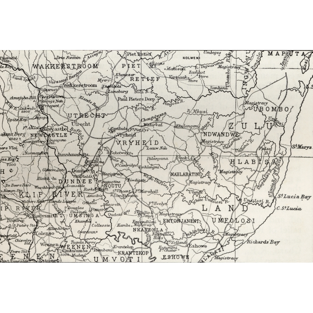
Posterazzi Map of Zululand & Adjoining Portions of Natal At The End of The 19th Century From The Book South Africa & The Transvaal War, Volume 1 by Louis Creswicke Published 1900 Poster
Map of Zululand & Adjoining Portions of Natal At The End of The 19th Century From The Book South Africa & The Transvaal War, Volume 1 by Louis Creswicke Published 1900 Poster Print Map Of Zululand And Adjoining Portions Of Natal At The End Of The 19Th Century. From The Book South Africa And The Trans is a licensed reproduction that was printed on Premium Heavy Stock Paper which captures all of the vivid colors and details of the original.Perfect for any room! This print is ready to frame or use removable mounting putty to hang the old fashion way. Features Designed with precision and functionality Value for money Superior quality design Wide collection of posters to choose from Choices for every styleSpecifications Artist: Ken Welsh & Design Pics Size: 34 x 24 in. - SKU: PSTRZ78315
Shipping & Returns
Shipping & Returns